
Know Exactly Where the Sun Shines in Your Garden
Map sunlight and shade patterns across your garden with 3D precision. Plan what to plant where, based on real sun exposure data.
Without SunTrace3D
Guessing about sun exposure
"Full sun" or "partial shade" labels don't tell you how many hours of direct sunlight each area actually gets.
Shadows change with seasons
An area sunny in summer might be fully shaded in spring when you're planting. You need year-round data.
Buildings and trees block light
Nearby buildings and trees cast shadows that are hard to predict without seeing the 3D geometry.
With SunTrace3D
Precise sunlight heatmap
Color-coded overlay shows exactly how many hours of direct sunlight each zone gets, accounting for all surrounding structures.
Year-round shadow tracking
Simulate shadows for any day of the year. See how shade patterns change from spring planting through fall harvest.
Plant-matched zones
Use the garden planner to design beds and select plants matched to each zone's actual sunlight conditions.
Sunlight Heatmap
Overlay a color-coded heatmap showing annual sun exposure across your entire site. Instantly identify the sunniest and shadiest zones.
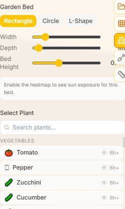
Garden Bed Planner
Design garden beds and choose from a database of plants suited to your sunlight conditions. Plan where to place sun-loving or shade-tolerant species.
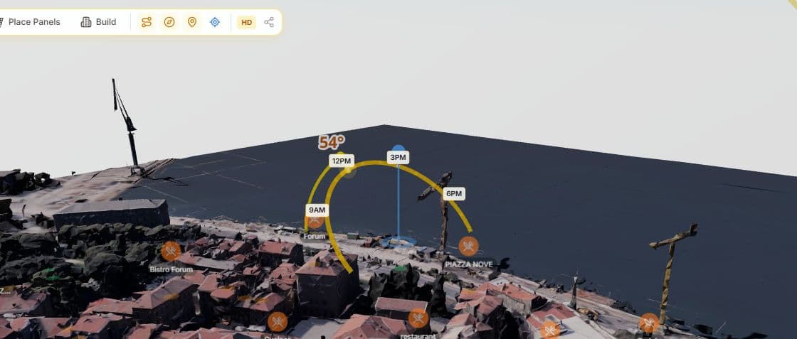
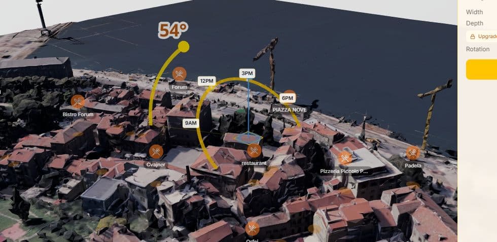
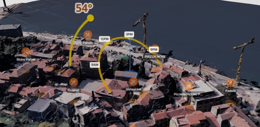
Sun Path Visualization
View the sun's arc across the sky for any date. See exactly when and where direct sunlight reaches different parts of your site throughout the year.
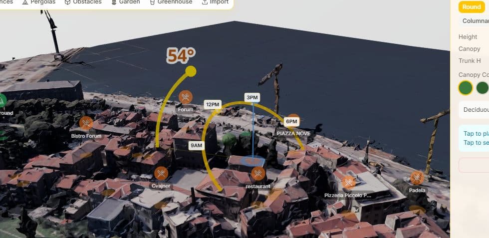
Scene Objects
Add trees, fences, pergolas, greenhouses, and other objects to the scene. See how each element affects sunlight and shadows on surrounding areas.
3D Measurement Tool
Measure distances between buildings, trees, and property boundaries in full 3D. Essential for setback calculations and shadow impact assessments.
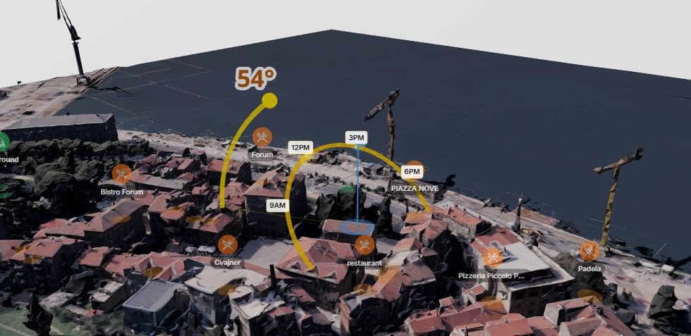
Real-Time Shadow Simulation
Scrub through any hour of any day to see exactly where shadows fall on your property. Watch how sunlight changes from sunrise to sunset across all four seasons.
How It Works
solutions.howItWorksSubtitle
Load Your Garden in 3D
Enter your address and see your property with all surrounding buildings and trees in photorealistic 3D.
Map Sunlight & Shade Zones
Enable the sunlight heatmap to see color-coded sun exposure across your entire garden area.
Plan Your Garden Beds
Use the garden planner to design beds and choose plants suited to each zone's sunlight conditions.
Frequently Asked Questions
Does it account for shadows from my house and neighbors?
Yes. The 3D models include all surrounding buildings and structures. Shadow simulation is based on real geometry, not estimates.
Can I see shade patterns for different seasons?
Yes. Use the date picker to simulate any day of the year. See how shadow patterns change from winter solstice to summer solstice and everything in between.
What plants are in the database?
The garden planner includes flowers, shrubs, and vegetables with sunlight requirements (full sun, partial shade, full shade) so you can match plants to zones.
Can I add trees and structures to see their shadow impact?
Yes. Add trees, fences, pergolas, greenhouses, and other objects. Each casts accurate shadows so you can plan your layout around them.
Is this free for home gardeners?
Yes. The sunlight heatmap, shadow simulation, and garden planner are all available in the free tier. No signup required.
Ready to map your garden's sunlight?
Start free — no credit card needed